Drone Inspections
Thermal and LiDar Inspections
Advanced Asset Insights
Highland Drones offers drone inspection services using thermal imaging and LiDAR technology to provide unmatched insights into asset health, structural integrity, and environmental data. Our inspections minimize downtime, optimize maintenance, and deliver accurate results.
Thermal Inspections
Thermal drone inspections deliver quick, accurate thermal imagery, enabling immediate identification of potential issues, such as:
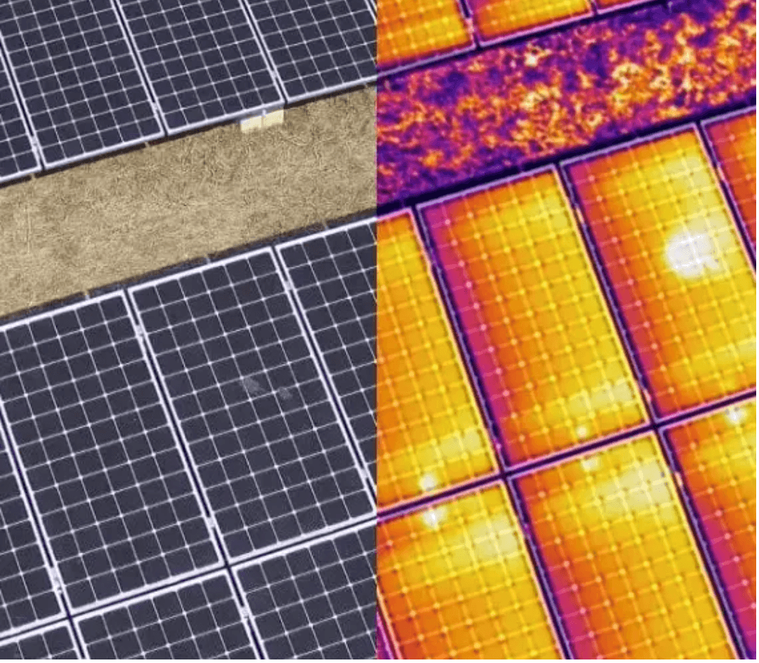
Solar Panel Defects:
Detect faulty cells and wiring issues, maximizing solar output. Panels with defects can show up to a 30% loss in efficiency, meaning prompt identification keeps systems running at peak performance.
Electrical & Mechanical Systems:
Identify overheating components before they cause failures, extending the life of valuable assets and minimizing repair costs.
Building Envelopes:
Scan for heat loss, insulation deficiencies, and water intrusion, particularly important in large-scale industrial and commercial structures.
LiDAR Inspections
LiDAR technology enables rapid 3D mapping and data capture, offering immense value for industries requiring detailed and accurate surface data.
Construction & Infrastructure:
Generate precise topographic maps and measure structural integrity, aiding project planning and safety.
Agriculture & Forestry:
Conduct comprehensive vegetation analysis and tree counting for yield prediction and forest management, reducing manual labor and boosting data accuracy.
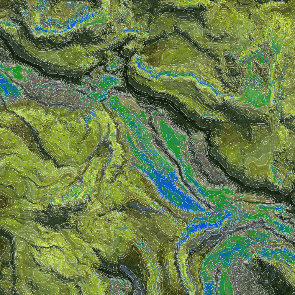
Environmental Monitoring:
Measure changes in landscapes over time, such as erosion, landslides, and flood zones, helping predict and prevent environmental impact.
Why Choose Highland Drones?
Efficient, Risk-Free Inspections
Highland Drones’ thermal and LiDAR inspections save costs, reduce downtime, and enhance safety by accessing hard-to-reach areas without scaffolding or manual methods, offering a faster, safer, and more effective maintenance solution.
Contact us
Ready to maximise your asset performance with drone technology?
Email: cam@highlanddrones.co.nz
Phone: 0279557145